
I joined an Overseas Adventure Travel Tour with a small group of 15. I was impressed with the OAT mission statement ... to discover the mystery and romance of this North African crossroads of history—from the ruins of ancient Carthage to the Romans who left many impressive legacies. For 15 days I explored this fascinating land from its rich Mediterranean coast to Saharan oases deep in the interior.

Along the way we met Tunisians and experience their culture—a bit of the Arab world with a French twist—under the expert guidance of a native Tunisian guide we came to know as Mohamed Mastori. His impressive knowledge of Tunisia and his love for the culture was punctuated with an easy flow of humor.

Our tour bus was driven by a capable, helpful and friendly gentleman who was always impeccably dressed with suit and tie. We could not have asked for a better driver.
THE JOURNAL
DAY 1 MONDAY, May 2 th
This morning I was assisted in packing my suitcase by my always helpful and supportive wife Annette.
Whenever she packs my luggage the cats sense my departure and climb into the suitcase. Here
“Shadow” is pictured intent on going along.

Annette dropped me off at the MSP International Airport for my nonstop Air France flight to Paris.
Security personnel not only gave me the full body scan. but singled me out for a comprehensive pat down.

The flight time was 8 hours and forty minutes, but compared to my Asian trips it seemed short. As
always, the Paris Charles DeGualle Terminal impressed me with its unique geometric designs.

In the five hour interval between flights I camped at Gate F44. Margaret and Barbara spotted my yellow
OAT luggage tag and introduced themselves as fellow Tunisian explorers.

DAY 2 TUESDAY May 3rd Arrive in Tunis

minutes flight.

Mohamed was waiting for us outside customs with his yellow OAT sign and greeted us as we
assembled for transfer to our hotel.

The bus ride to the Tunisian Palace Hotel provided many photo opportunities because we drove along
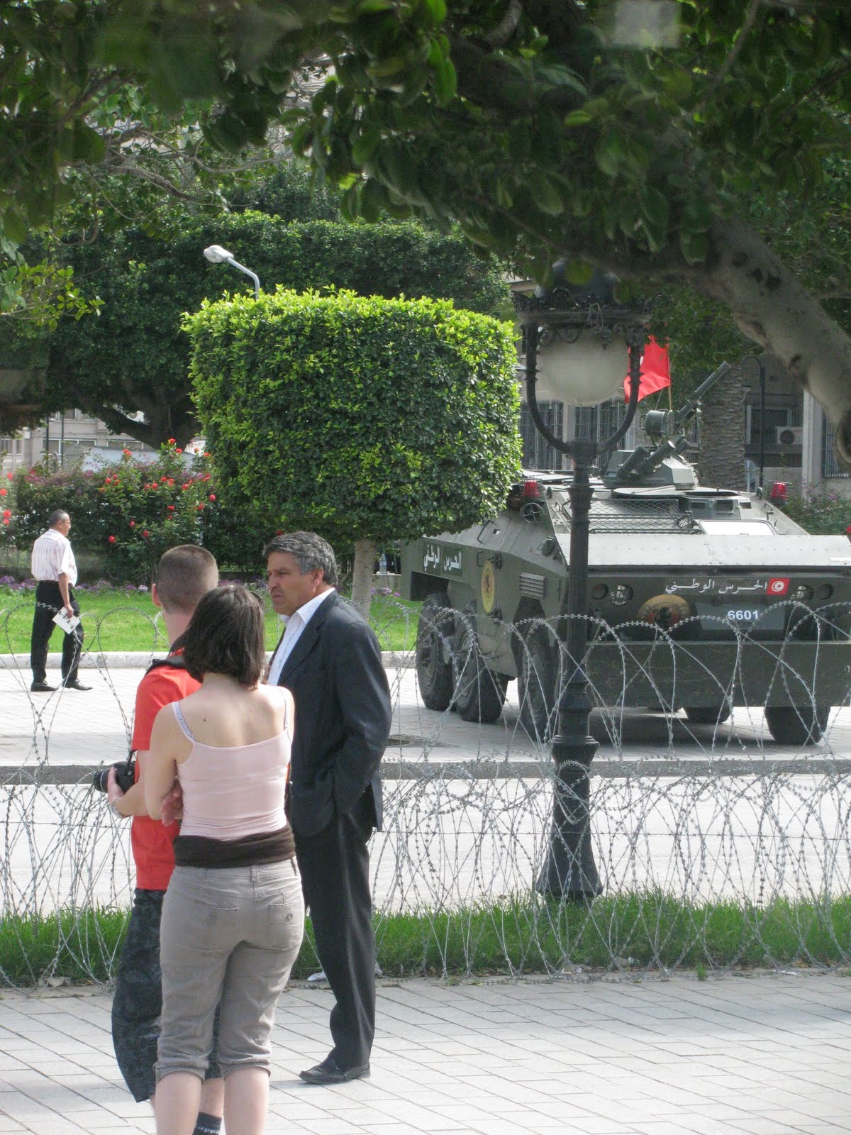
Avenue Habib Bourguiba -- starting with the November 7 Monument where the Revolution of January 14, 2011 began. I took all of the following photos from a moving bus.

It was on January 14th that the President of Tunisia was forced to abdicate and flee the nation. The nation is still in a transitional stage awaiting free elections. Along this main drag leading to our hotel large groups still assemble (usually peacefully) and army units make their presence known and establish safeguards against any possible violence and unrest. Secure areas are marked off with barbed wire and armored vehicles.


When OAT had to cancel my May 13th date, and later my May 9th substitute date, they offered to
refund my money. But I rescheduled to this present trip which started May 2nd. No sites had to be curtailed and the the tour went smoothly.

The Palace Hotel staff was waiting for us with a nice cool refreshing welcome drink. Mohamed had us meet for an orientation session where we introduced ourselves to each other.

From here we stepped outside for a closer look at the exterior of our hotel to see the influence of the French on its style.

Over the archway entrance were sculptured columns

We walked across the busy street to Place de France and the large market place that resembled a mall.

Just outside was one of the many ornate lamps that contributed to the atmosphere.

I chose to view the Cathedral of St. Vincent de Paul (1882) which has been mocked in Rough Guide and Lonely Planet as ugly and monstrous. According to Insight Guide: "Its heavy, stolid architecture embodies the spirit of colonialism rather than anything holy." Anti-French bias.

Troops protect the Ibh Khaloun Monument (in front of the Cathedral) from demonstrators.

The leading Tunis newspaper featured the recently killed Osama Bin Laden on the front page.

The included Welcome Dinner that evening was held at the hotel restaurant located just beyond this eloquent lobby area.

The dinning room ceiling looked French Second Empire because of the shape of the dome.

We were served an excellent fish dinner that evening.

Great start for our wonderful adventure in Tunisia.

DAY 3 WEDNESDAY
We met on the bus after a comprehensive buffet breakfast and departed for Carthage at 8 am.

One can trace our journey on the map above -- moving from left to right.

Mohamed used the trip across the causeway as an opportunity to acquaint us with the history of ancient (Punic) Carthage which he distinguished as BC over against the later Roman Carthage of AD.

Ancient (Punic) Carthage evokes the romance of the legendary era of Queen Dido and Aeneas
chronicled in Virgil's Aeneas. Carthage was by far a stronger sea power than Rome for centuries. See map above which shows Carthaginian held territory in the early 3rd century BC. Our first stop was at Tophet cemetery to view the graves of children from the Punic period.

Most modern archaeologists agree that child sacrifice was performed by the Carthaginians at the spot of the Tophet. At this spot, hundreds of headstones over children's graves are still standing, and in the ground have been found bones of both animals and children. We hear of child sacrifice from both legends and Roman stories (propaganda, says Mohamed). But while these rituals most likely have been performed, they were hardly as common as claimed. Some guidebooks state that they were only performed in times of extraordinary hardship. They say that in many cases, the Carthaginians used lambs or kid goats as replacement sacrifice, and some cases perhaps even dead children.

Evidence from classical authors. Ancient authors, both Greco-Roman historians like Kleitarchos, Diodorus and Plutarch and Church fathers like Tertullian, condemn the Carthaginians for the practice of child sacrifice. Some say the tiny child was brought to the idol, calmed by a priest and its throat cut. It was then placed in the arms of a bronze statue that had a furnace or grate beneath it. Yet, some sources state the child was not killed first.
In the Bible: Tophet the same as Topheth; from Hebrew: toph, “a drum,” because the cries of children here sacrificed by the priests of Moloch drowned by the noise of such an instrument; or from taph or toph, meaning “to burn,” and hence a place of burning. Molech was a god worshipped by the Canaanites, Phoenicians and Ammonites.

Mohamed led us around the grave sites of children that had been buried at Tophet.

Here at the upper level of the cemetery were the grave sites of children who were among the last to be sacrificed.

Mohamed explained the meanings of the inscription on the tombstones.


From the upper level of the cemetery, I took this shot of a lower level. These were the graves of those victims who were sacrificed at an earlier time.

Only a short distance away our bus stopped for us to take photos of what had been the Punic Port of Carthage.


Along the banks fishermen were preparing their nets for the day.


As we walked along Mohamed drew our attention to some baby olives

Ahead of us were the Antonine Baths IG p. 147 The central pool was as big as an Olympic pool. The curved public latrines were at first taken for a theatre. Very little of the upper structures remain, but the lower halls are so huge and extensive that it is difficult not be amazed.


The baths were constructed from 145 to 165 CE, and is perhaps the best illustration as to how rich and wealthy Carthage was during the Roman era. They were the largest in North Africa, and third largest in the whole Roman world.

Next to the site is a modern presidential palace guarded by soldiers who do not like being photographed. Mohamed said they seize rolls of film from unwary tourist who photograph them. Better to stick with postcards, as we did (see above).
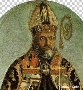
Baths of Gargilius is now just a building with columns, or what’s left of it, where St. Augustine called a conference of bishops in 411 to trick the dissident Donatist church into being a party to its own prohibition (RG p, 127). The Donatist held that the church must be a church of saints, not sinners, and that sacraments, such as baptism, administered by false Christians (Christianswho surrendered the Scriptures to the authorities who outlawed possession of them) were invalid. Augustine is admired by both Catholics and Protestants.


By the parking lot there is a monument to the super hero Hannibal who made a famous but doomed campaign against Rome in the 2nd Punic War. Hannibal took the short sea crossing to Spain, crossed the Alps with elephants, marauded in Italy 15 years before attacking Rome (which cost the lives of all but one of the elephants).

Our next destination was Byrsa Hill (on map above) where St. Louis Cathedral dominates the site. It was built in 1890 and was dedicated to the 13th century French king who died at Carthage while laying unsuccessful siege to Tunis during the Crusades. Rough Guide refers to it as a “pseudoOriental heap, ” which may be a little harsh. Because the building now houses concerts it had a name change and is now called the Acropolium.

The entire site is visible from the summit. This was the spiritual heart of the ancient city. It was occupied by a temple to the Carthaginian god Eschmoun. The reason why this little quarter survived until modern times, was that the when the Romans decided to rebuild Carthage 100 years after its destruction they leveled the top of the Byrsa Hill, and what wasn't destroyed then was saved beneath the rubble. Cinders confirmed that Carthage did burn for 17 days.

The Romans built an aqueduct here that is still visible (above).

More important for our mission was to view the great Punic ruins located just below us. See photos a below.


Our bus driver took us over to Sidi Bon Said where we embarked on an ambitious walking tour. Sidi Bon Said is located only 20 km from the capital of Tunisia. The town received its name from a Muslim religious figure who lived there.


Lonely Planet states that the distinctive architecture is Andalusian inspired a result of the influx of Spanish Muslims in the 16th century. Those of us who have visited southern Spain will probably notice similarities.

Sidi Bou Said still has a reputation as a town of artists. Many famous artists lived here or visited Sidi Bou Said, and are/were members of Ecole de Tunis (painting school of Tunis). 18th century Turkish governors of Tunis and wealthy citizens of Tunis built residences in Sidi Bou Said. See RG pp. 128-129;
LP p. 90; IG pp. 148-149.

Mohamed halted our walk for a Discovery Moment. He ordered freshly baked donut type pastry and distributed them among us. Nice break.

When it was time to return to the bus, Mohamed had us walk along the back alley for different scenery.


General Rommel, commander of the Axis forces, was relentless against the inexperienced Allies at Kasserine Pass. But the Allies regained footing, broke through the Mareth Line—fortifications originally built by the French to guard Tunisia from Italy—and defeated the German-Italian forces. Desert War See IG pp. 62-63 and RG Map p. 124.

German and Italian POWs, following the fall of Tunis, 12 May 1943. Over 230,000 German and Italian troops were taken as prisoners of war. The Joke Book of History jokes that Italian soldiers practice military maneuvers by raising their hands in surrender because of this episode. Actually, many Italians were not really eager participants on the side of Germany.

We are lunch in a Jewish kosher restaurant called N Camie Lily. I sneaked back into the kitchen to see the cooks at work.

The setting was of a family establishment.

After remarks from the Jewish owner, we joined a discussion on Jewish culture in Tunisia throughout its history. Jews in Tunisia have always tread a precarious path between social acceptance and downright oppression. Tunisia has had a Jewish minority since Roman times. In 1948, the Jewish population was an estimated 105,000, but by 1967 most Tunisian Jews had left the country for France and Israel, and the population shrunk to 20,000. As of 2004, an estimated 1,500 still remain, particularly on the island of Djerba, which is noted for its synagogue, and comprises the country's largest indigenous religious minority Tunisian Jews have always been subject to shifts in regional and international politics that have dictated the relative security of their community. As the Oslo Peace Process has eased tensions between Israel and the Arab world, the Jews of Tunisia are once again able to practice their religion in public and with pride.


Lunch was very tasty. Of course there was the standard fare of tasty seasoned rice.
After lunch we visited the famous Bardo Museum, Tunisia’s national museum of archaeology Map RG p. 111; info 107-113; much detail of holdings LP pp. 56-64; See also IG pp. 135-138. Located in an 18th-century royal palace, it displays a spectacular collection of ancient Roman mosaics along with sarcophagi and statues from the Roman and Carthaginian periods.

Mohamed had a good grasp of knowledge about the mosaics and what the illustrations depicted.
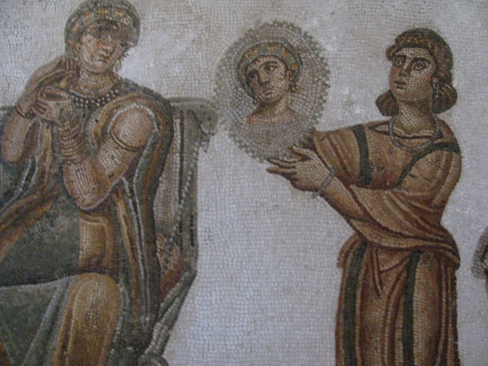
Ceremonial Dressing (above)


The God Neptune and the Four Seasons, 3rd century AD

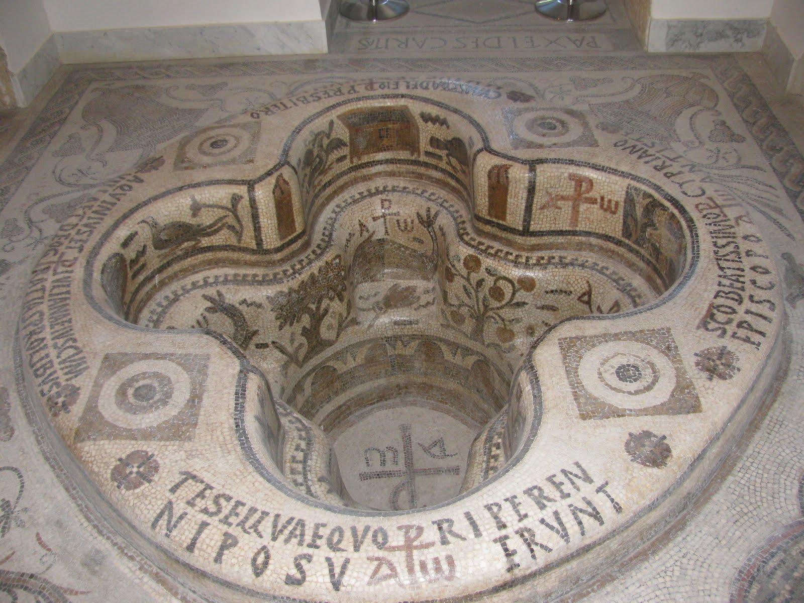
I was intrigued with the Baptistry Pool in the Early Christian Room on the First Floor. The immersion font is in the shape of a Greek cross from a 6th century church in Cap Bon.


Much of the marble statuary had evidence of the systematic de-nosing and emasculation of male statues by the invading Vandals.

From the Bardo Museum we headed to the Place de la Kasbah Center, just outside the Medina. Photo above is of the 13th century Mosque

National Monument surrounded by Tunisian flags.

The walls which once enclosed the Medina Tunis long since disappeared, apart from a few town gates, and their place has been taken by a ring of streets around the old town, which is in the form of an oval measuring 1,640 yds from north to south by 880 yds from east to west. It is the largest Medina in Tunisia and the finest after the Medina of Kairouan. Originally going back to the ninth-11th centuries, it dates in its present form largely from the Hafsid (13th century) and Turkish (17th-18th century) periods. The French demolished its outer walls but left it otherwise unchanged.

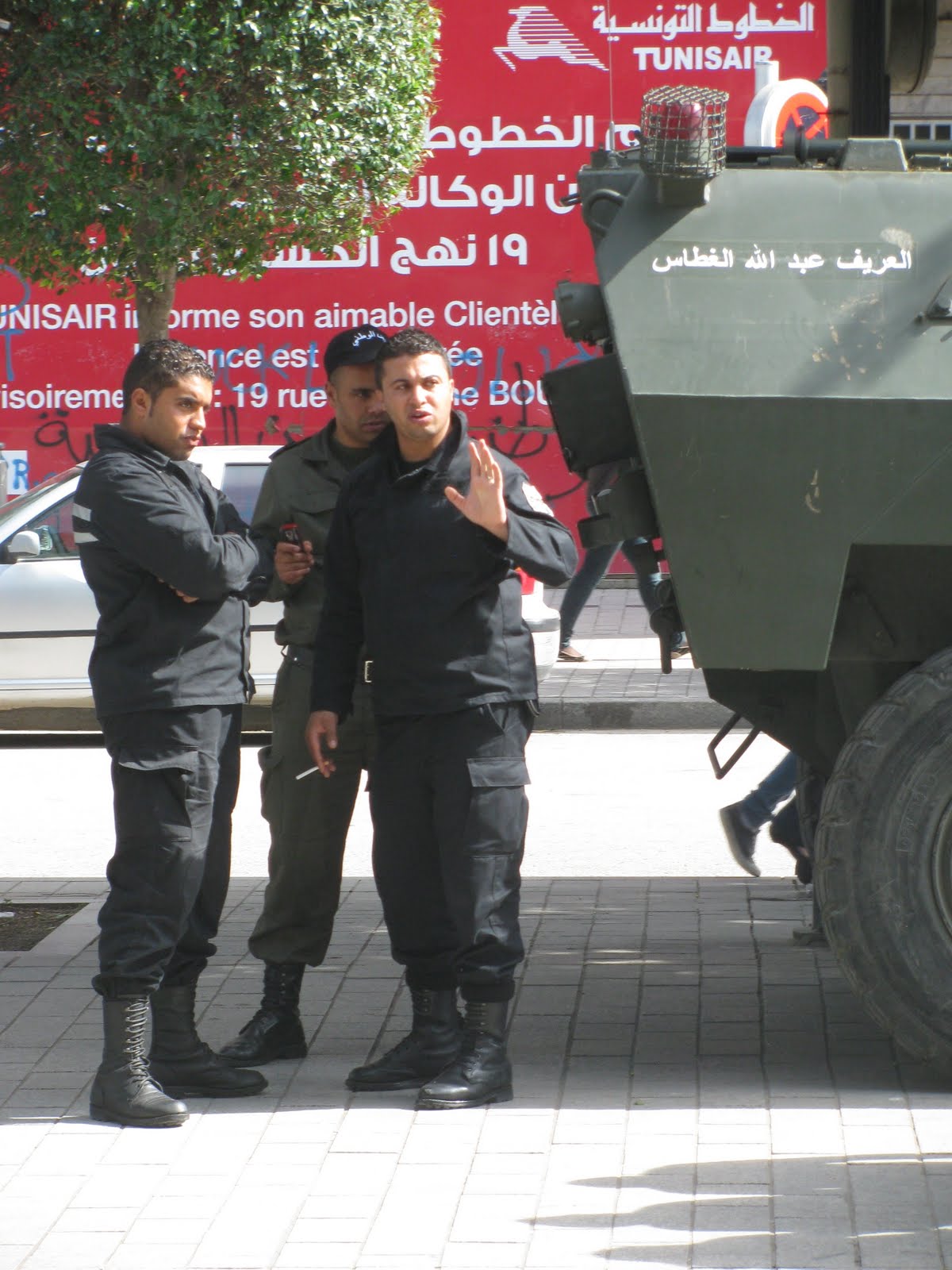
We then concentrated on the Government Center by the entrance of the Medina. Of course, there was the evidence of security.

We walked past the modern government buildings where the prime minister has his office at the Dar al Bey which is used as a royal guest house.Note the barb wire (above).

Then we walked around the narrow passageways of one of the greatest cities in the world during the reign of the Almohad and Hafsid dynasties from the twelfth to the 16th centuries. The Medinais a UNESCO World Heritage Site Map RG 75, & 86 & 88; info pp. 84-7; Insight Guide pp. 123-139; see also LP pp. 65-76.

We skirted the Zitouna, the Great Mosque IG pp. 126-127. This is the main mosque of Tunis. In terms of age and reverence, it is second to the great Mosque of Kairouan -- although it appears more ancient. The builders recycled 200 columns from the ruins of roman Carthage. It was closed down by President Bourguiba shortly after independence to reduce the influence of religion on society. LP p. 67. The facility was reopened in 1987.

Mohamed drew our attention to the beautiful gates and windows. While the houses might be simple and unadorned, wealth was expressed through the workmanship of the wooden elements.

He also led us through expensive cafes that hadn’t changed in a hundred years. Prices for dinners were jotted down for those who might care to come back this evening. We encountered young people along the way (above).

The young people played a major role in overthrowing the corrupt government back in January of this year. Technology greatly aided communication. I saw one scrawling of graffiti that said: “Thank you, Facebook!”

We wandered past the vendors in the 'Suuq' the Arabic name for market Today, the medina is still inhabited, but only a small percentage of the total population of Tunis lives in these quarters. There are areas for goldsmiths, metal workers, fabrics and tourist items. Prices were generally higher here but when shopping you are expected to haggle over the prices.

At the end of the market place stood the Bab el Bahr which means "Gate to the Sea". Before the French came in the 19th century, that was exactly what it was too. Then there was just open grounds here, leading down to the lake of Tunis. For the French the Bab el Bahr became a symbol, as the gate between the Oriental part and the European part of Tunis. Hence its other name came to be "Porte de France".

The free-standing gate was surrounded with space and served as a gathering place for socialization.

When we stepped through the gate we entered the European sector with the symbols of the French colonizers. The distance to the hotel from here was only a number of steps. Dinner was on our own so I ate my carryover orange from breakfast and a health bar. Some of more energetic members stepped out in the night air amidst the throngs of people gathering to express new found freedoms. News the next day announced that a curfew had been reinstated.
Lodging: Tunisian Palace. Sleep came easily after such a full (and fruitful) day in Tunis.
DAY 4 THURSDAY, May 5th

I had a 6:30 am wake up call, had breakfast at 7, and then met the group in the lobby by 8 am. Today we embarked on a full-day tour of ancient Dougga RG Map 306-307; info pp. 304-310, LP pp. 138-142 ; IG area map p. 170; good city map p. 189, the best preserved ancient Roman city in North Africa and a UNESCO World Heritage Site.
The location is ideal, as it is fairly close to the heartland of the Carthaginian territory. It first served as an important military post and with the arrival of the Romans it became a regional administrative center. Still there could have been hardly more than 10,000 inhabitants (OAT uses the figure 5,000, as does Lonely Planet) in its heyday. There was not much shade so I needed a hat and sun screen. Lonely Planet estimates it takes about 3-4 hours to take in the highlights.

The long drive necessitated a happy stop for break at Medjez el Bab

We continued on through some nice scenic areas.

Our bus pulled over for a worthy stop in Testor. The Great Mosque that could be seen from a distance had been put up with all that should demonstrate the pride of the refugees. With the Reconquesta in Spain, Muslims and Jews alike immigrated to this area and established buildings with an Andalusian flair

The minaret is particularly interesting as it has two Star of David symbols on the eastern side, probably an emblem of unity between the two exiled religions. The minaret is also one of very few in the world which has a clock. Its numbers are symbolically placed backwards as a sign of the exiles who wished to turn back the clock to when they were happily settled in Andalusia. The clock has long since lost its hands.


The building to the left of the minaret has a ribbed roof made from local tiles.

As we continued our journey I could not help but take a photo from the bus window of tiered mountains to my right.

At last we reached Dougga, abandoned and deserted after the Vandal invasion, and since then there has only been a small village on the other side of the hills. Here stand the remains of a complete town that once, included villas, temples, baths, a paved street, and a forum, making it easy to imagine life in this place in the second century AD. The city was built on the site of a Numidian settlement, which explains why the streets are so uncharacteristic tangled.

We pulled into the parking lot opposite the Grand Theatre IG, p. 190 which dates back to 168 CE, and was donated to the city by one of its wealthiest families. Much land is still non-excavated and isstill farmed.

It is currently used for the concerts at the Dougga Festival in summer. The theatre, built on a hill, has 19 tiers, and space for 3500 spectators. It is difficult to believe that this site was entirely underground before excavation.

We moved on toward the next site, the Capitol


The Capitol was located to the right of the Forum (upper left part of map)

We spent much time with the Capitol which must be one of the most impressive remains from the Roman era. Built in 166 CE, its 10 meter high walls stand almost like the day it was inaugurated. The walls may seem crude and ordinary, but they are the best examples of the technique known as opus africanum, where large stones strengthen walls made from smaller stones.

The portico rests on six impressive columns, and opens up the interior. The Capitol served as the main temple for the entire city, and it was dedicated to the three gods of Jupiter, Juno and Minerva. The three gods each had their niche, Jupiter had the large one in the middle. Here a six meter high white marble statue once stood.

The Forum IG, p. 195 of a Roman city was the central place where official ceremonies were performed and where people mingled. It lies beneath the Capitol and was erected towards the end of the 2nd century CE. Originally, it had 35 columns made of red/orange Chemtou marble with white capitals. Little of that has survived to our times. Byzantine fortifications used much of the building stones from the Forum or its structures.

A view of the Capitol from the Forum

The Underground Cistern (above)

We walked over to a large residence where we could view the ancient aqueduct system (above).

Mohamed took this group picture (above) with my camera.

There are plenty of houses of Dougga which can roughly be divided into two types. Carthaginian has an entrance leading into a court, then with the entrance to the side into the dwelling quarters. Roman, on the other hand, had direct access into the dwelling quarters.


The Licinian Baths have much of its original walls intact, as well as a long tunnel used by the slaves working at the baths. The baths were donated to the city by the Licinii family in the 3rd century. They were primarily used as winter baths. The frigidarium has triple arcades at both ends and large windows with great views over the valley.

The funnel or cave that led to Cyclops Baths

The Cyclops Baths are now in disrepair except for the sociably horseshoe-shaped row of 12 latrines just inside the entrance.

The Libyco-Punic Mausoleum (above) IG p. 193 to the south is perhaps the finest structure to survive from the time before the Romans. The Libyco-Punic Mausoleum dates back to 3rd century BCE. It was dedicated to the Numidian Prince Ateban. The architect drew on influences from both Greece and Egypt. The roof is nothing less than a small pyramid.

We enjoyed lunch at a local restaurant that featured wild boar and even had a stuffed boar’s head on the wall.


After a wonderful salad we dug into the wild boar plate. Very good dinner.
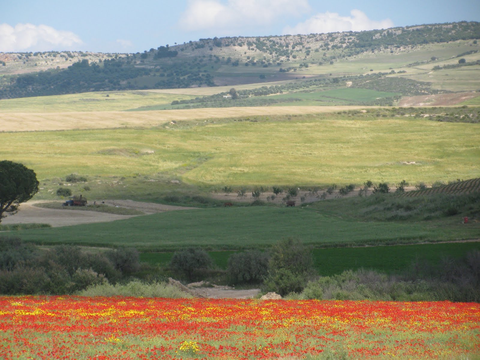
On the trip back to Tunis, Mohamed had the bus pull off the road for two photo stops. The first was for flowering poppies

And the second was for a river flowing under the highway bridge.

After a very successful day we returned to Tunis. Many demonstrators had gathered on the street by our hotel. Mohamed talked to the police and they allowed us to continue on to the Palace Hotel. The crowd was not unruly, but their number led to a resumption of a curfew. We slept well that night.
GO ON TO 2011 TUNISIA PART II KERKOUANE, KAIROUAN ....